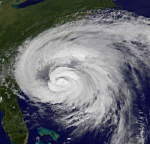
As you can tell by the title of this entry, I’m not going to touch upon the normal topics today because most of you-at least, those living on the East Coast-have other things on your minds at the moment. Hurricane Irene is already battering the Eastern Seaboard and, based upon the latest reports, is steadily gaining strength. Our thoughts and prayers go out to the 60 million or so Americans who are in the path of the storm, especially those North Carolinians currently experiencing the worst of it.
For those trying to track Irene in order to make the necessary preperations, there are some great resources at your disposal. The National Hurricane Center has a public advisory tracking the storm and warning those in its path. Weather Underground has some fantastic models of Irene developing in the next 24-36 hours. For my fellow New Yorkers, I highly recommend you peruse a map from the New York Times that plots the hurricane evacuation zones for the City. WNYC has also published a great map that points out the potentially endangered neighborhoods, which include most areas along New York City’s coastline.
We want all of you to stay safe and sound, which is why I’ve posted some of this information the day before the worst parts of this hurricane impact the Northeast. This looks to be an historic event, especially for those of us who’ve been lucky enough to live in New York, usually out of the reach of mother nature’s wrath. If you’re in the path of Irene, feel free to share your thoughts, stories, or pictures in the comment section below.


The Wall Street Journal has provided us with a county by county forecast for New York.